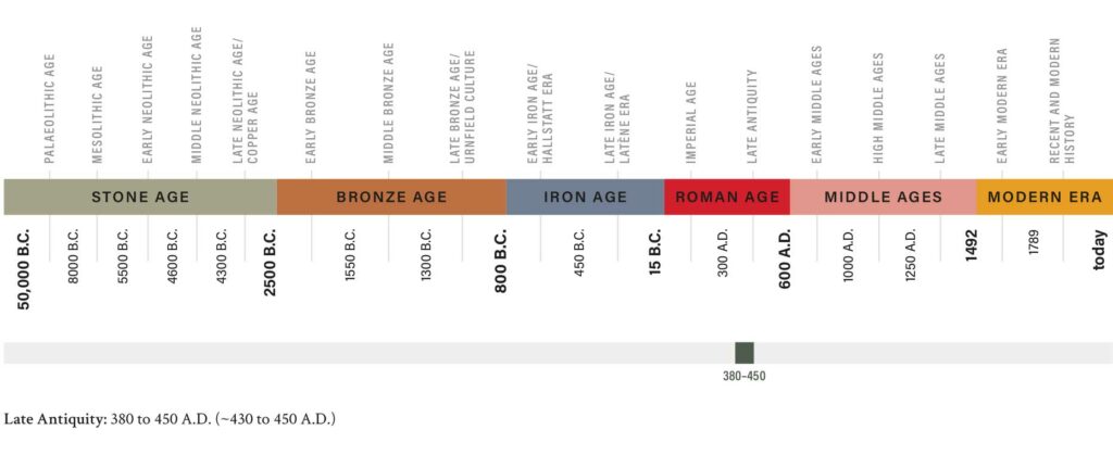
The Teufelsgraben (Devil’s Ditch) is a striking archaeological monument that extends over the entire Leibnitzer Feld and is still well preserved in some sections as a rampart-ditch complex. An excavation in 2005 by Kulturpark Hengist and extensive investigations provided evidence that the ditch was built in late antiquity between 380 and 430/450 A.D. It protected the settlement of Flavia Solva, located to the south. As a linear earthwork, the Teufelsgraben still served as a boundary line in the early Middle Ages and in modern times.
The Mystery of the Devil’s Ditch
For centuries, no one knew what the Teufelsgraben was once dug for. It is a 3.9 km long rampart ditch complex, which delimits the Leibnitzer Feld in the north between the two rivers Lassnitz in the west and Mur in the east. The ditch runs almost horizontally (282.5-284 m a.s.l.) across the Leibnitzer Feld in two nearly straight sections abutting at an obtuse angle. The complex consists of a southern higher and a northern lower rampart with a ditch deepened in the middle. As a fortification, it is thus oriented towards the north, while the area to be protected lies to the south. Today, the Teufelsgraben has been leveled over long stretches by agriculture or destroyed by gravel pits. In former times, however, it had a culvert at the Mitterweg, the path that crosses the Leibnitzer Feld in a straight line in a north-south direction and corresponds in its course to the Roman Mur valley road. Around Bachsdorf/Ost the Teufelsgraben can be traced over a length of 430 m. There it has a total width of 16 m, a clear width between the two wall crowns of about 6 m and a depth of 1.40 m in places.
Historical errors …
The Teufelsgraben has been known to researchers for 150 years and was mostly considered a 10th-century structure whose purpose was unclear or disputed. Recent investigations have provided evidence that the construction of the moat dates back to Late Antiquity, to the years between 380 and 430/450 A.D. In the course of an excavation in 2005, charcoal flakes were recovered that allowed radiocarbon dating. Historical considerations also suggest that the construction of the site is not to be associated with the archbishopric of Salzburg in the 10th century, as previously assumed. The area south of the Teufelsgraben was taken into possession only shortly before 970 A.D. through the deliberate settlement of serfs; there was no reason at all for the Salzburgers to build such an earthwork as a boundary marker.
… and their correction
During Late Antiquity, however, the Teufelsgraben fits perfectly into the well-known image of security measures and fortifications for the Roman population living in constant unrest. It is the period after the battle at Adrianople (today’s Edirne in Turkey) in 378 A.D., which was devastating for Rome, and as a result of which the Pannonian Limes gradually disintegrated and the Roman provinces in Pannonia were ceded to the Huns. Thus Noricum mediterraneum, whose easternmost city was Flavia Solva, became a frontier province. It can be assumed that the Teufelsgraben, together with another late antique structure, the Old Tower (“turris antiqua”) in Seggau Castle, served primarily for the surveillance of the bordering territory to the north as well as for the control of migratory movements, i.e. it represented an internal limes. In the early 5th century, the surveillance of barbarian foederates and the integration of Roman refugees from Pannonia became central tasks for the stabilization of the region. In addition, an earthwork such as the Teufelsgraben possibly secured agricultural production and subsistence for the civilian population at a time (from the late 4th century onwards) when supply from villas in the surrounding countryside had already come to a standstill.
The Teufelsgraben in later centuries
The late antique site remained a prominent terrain feature and was used again as a northern boundary in the 10th century, this time for the early medieval successor settlement of Flavia Solva, the civitas Zuip. It was first mentioned as a ditch (“fossa”) in 982 A.D. in a document by Emperor Otto II, which defined the boundaries of the civitas Zuip and confirmed the Archbishopric of Salzburg as the owner of the territory.
The Teufelsgraben, whose original purpose was forgotten in the course of the centuries, was used within the flat Leibnitzer Feld as a borderline between political-administrative areas until modern times. In the Middle Ages, for example, it separated the Habsburg and Salzburg territories from each other, and later the district courts of Oberwildon and Seckau (Seggau). The preserved district court cross from the 17th century, erected in the area of the passage at Mitterweg, marks this boundary. On the north side it bears the coat of arms of the Princes of Eggenberg auf Oberwildon, on the south side that of the Counts of Thun, the Prince-Bishops of Seckau. Both coats of arms are weathered almost beyond recognition. Even today the Teufelsgraben forms the municipal border between Lang/Tillmitsch and Lebring/Gralla.
Text: Mag. Dr. Stephan Karl